by Brian Kenny | Jul 5, 2019 | Kerry
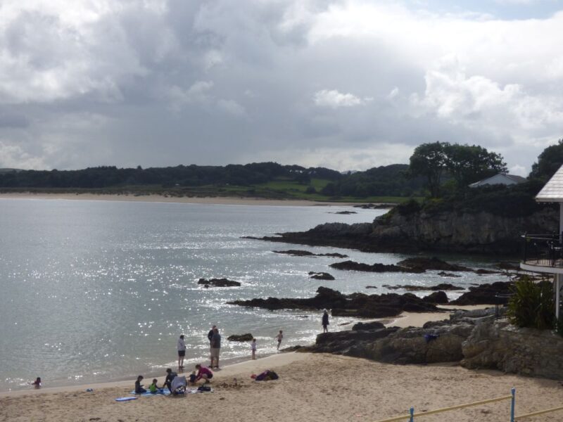
Ballinskelligs Beach
July 2009
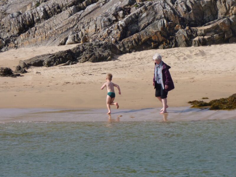
Ballinskelligs is a real family beach with some decent facilities. The beach itself is curved and nice and sandy. The water is clear and there is a gentle slope into the sea.
At one end of the beach there is a ruined tower which you access across a stream. It looks like a good place for kids to explore. At the entrance to the beach itself there is a nice coffee shop with indoor and outdoor seating
Ballinskelligs has lifeguards in the summer, a decent car park and public toilets. The beach appears to be reasonably accessible.
Blue Flag beach.
Directions
View Larger Map
Ballinskelligs is located off the N70 Ring of Kerry road. If you are coming from the Caherciveen direction you will take a right turn onto the R566. Follow the signposts which will lead you to the beach
Ordnance Survey Discovery Series Map No. 83


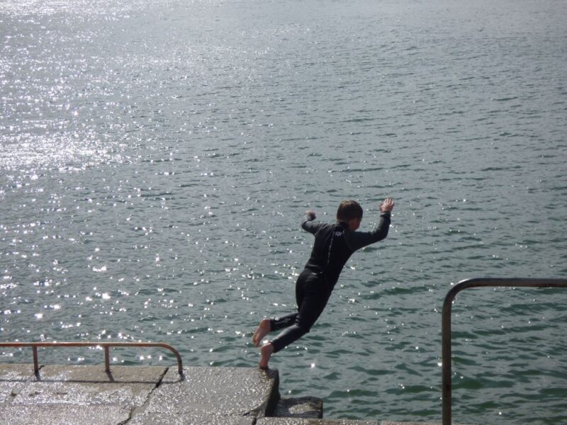
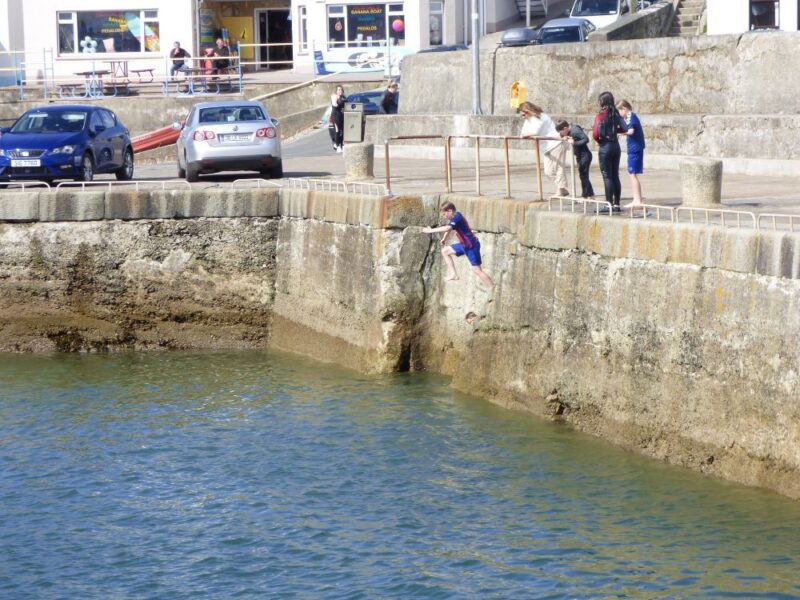
by Brian Kenny | Jul 5, 2019 | Dublin, Suitable for naturism, The Sea
The 40 Foot
July 2009
Is this Ireland’s most famous swimming spot? Dubliners probably think it is.
Immortalised in James Joyce’s Ulysses (although we can’t recall ever seeing snot green se there) and loved by generations of the city’s swimmers, the Forty Foot is a Dublin institution.
For most of its time the Forty Foot was a men only spot, where the male of the species could strip off in peace without being bothered. Eventually that changed (was it 15-20 years ago?) and now men and women, young and old, swim there, although there is a secluded part around the side where men still congregate and women rarely venture. The entrance still has the men only sign, but this is just a left over from a thankfully forgotten era.
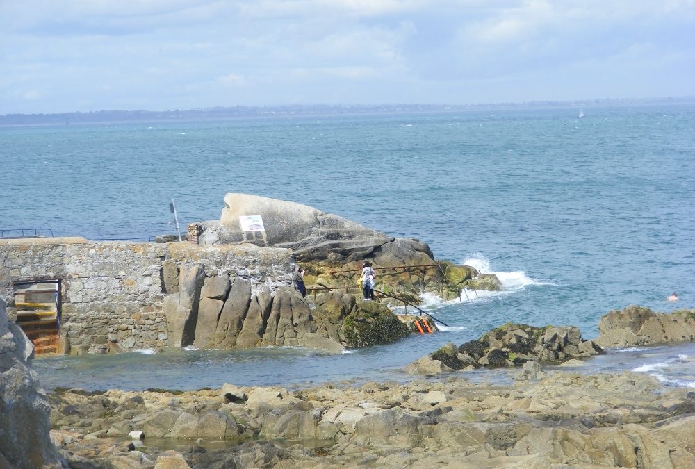
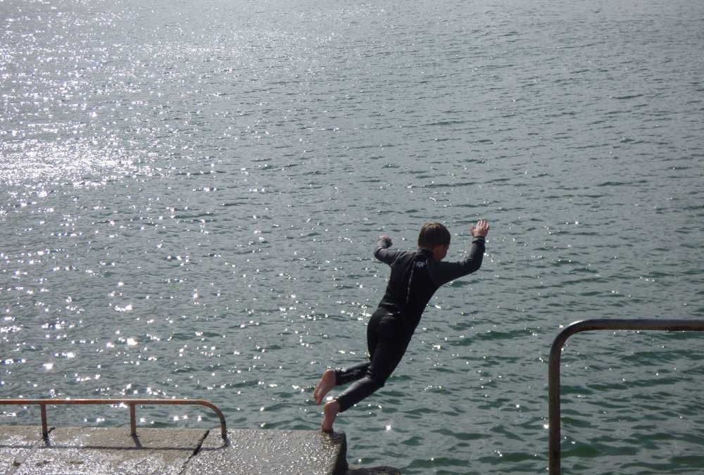
The great advantage of the Forty Foot is its depth, so you can always jump in even at low tide. It’s a great place to swim, with its clean deep waters. While people dive in from the nearby rocks
it is dangerous and you should heed the many warning signs which are obviously there for a reason.
This is, of course, a place for year round swimmers and in the depth of a freezing winter all you are allowed to admit to is the water being ‘a bit nippy’; wimps need not apply. Although we must admit to being envious on a recent winter visit where a swimmer emptied his hot water bottle over himself after his icy dip.
It is also the place where hundreds of people congregate on Christmas Day for an annual plunge.
The whole area is nicely maintained, with a changing area, and is a great credit to the Sandycove Bathers Association who keep it so well.
The 40 Foot is accessible for buggies, but there are a few steps which prevent wheelchairs.
Directions
View Larger Map
The best way to travel from Dublin city is by DART getting off at the Sandycove / Glasthule stop. From there it’s a 10- 15 minute walk and directions will be easily got.
This was for many years a traditional male only naturist bathing place. It is still predominantly, but no longer exclusively, used by men. It is situated just outside the town of Dun Laoghaire, 8 miles south of Dublin. In Dun Laoghaire follow the signposts for the harbour. Continue along the coast road until you come to the Martello Tower. The Forty Foot is nearby. It is used by naturists only in the early morning.
by Brian Kenny | Jul 5, 2019 | Donegal, Outdoor Pools
April 20010
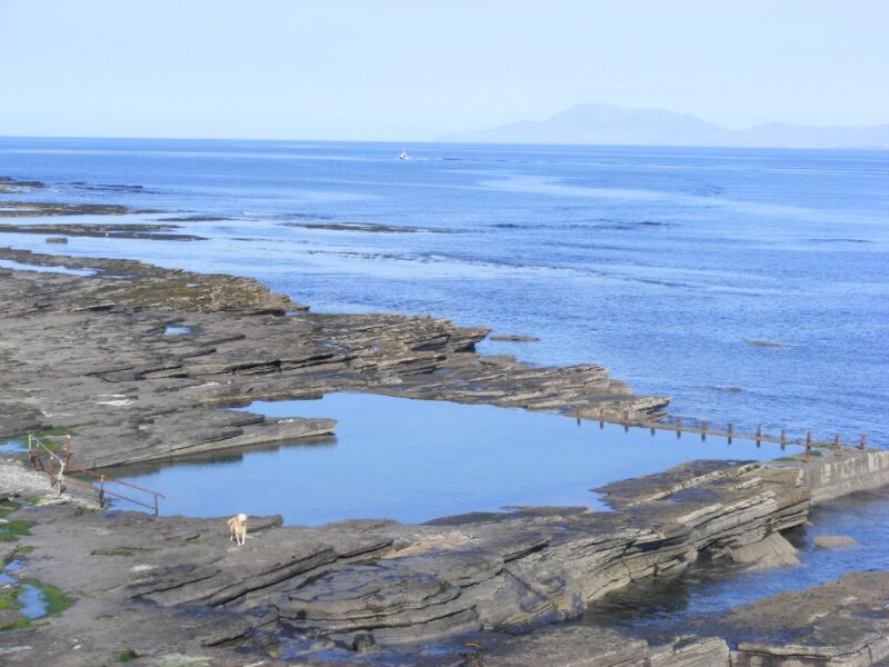
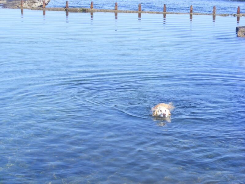
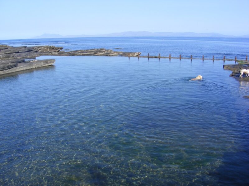
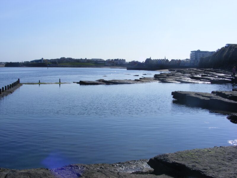
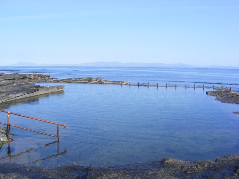
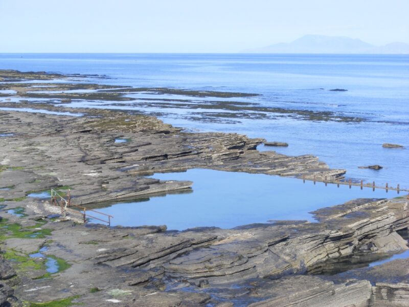
If you don’t fancy Bundoran’s beaches then the West End Pool is a very good alternative.
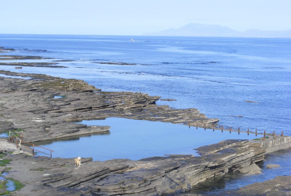
This is a large sea water pool, situated below an attractive coastal path. The pool has good depth and plenty of room. There are steps down from one side.
Don’t be put off by the photos, humans can swim in this pool too! There is also plenty of space to sit and look out across the clear blue sea (when it isn’t raining that is).
Access is down steps and then across the flat, large rocks. Not wheelchair or buggy accessible.
Directions
View Larger Map
From Sligo you come on the N5 toward Donegal / Bundoran and then take the R267 sign-posted Bundoran. As you drive into the town watch out for a sign post on your left for West End Bathing Pool.
Ordnance Survey Discovery Series Map No. 16
by Brian Kenny | Jul 5, 2019 | Donegal
August 2013
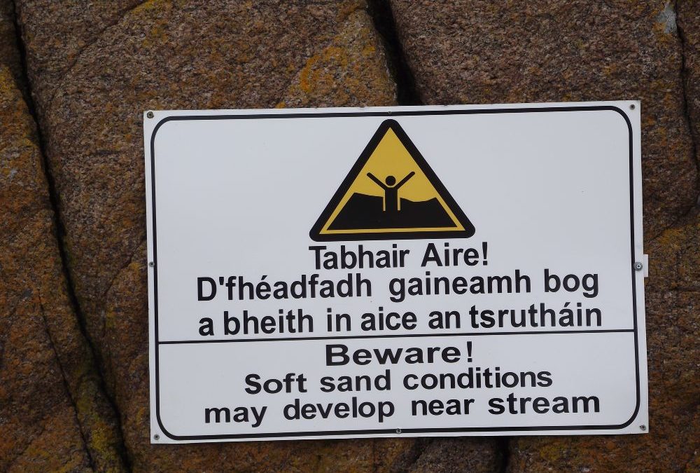
Carrickfinn is another of Donegal’s impressive Blue Flag beaches with a wide expanse of sand sheltered by peninsulas on either side. We arrived on a dull,cloudy day and certainly didn’t see it at its best. Despite this we had a grand swim in calm clear water with a few waves thrown in to keep the surfers happy. There was a gradual wade in and nice soft sand underfoot. It seems like a good spot for kids to splash and play.
Access to the beach from the small car park is along a sandy path which is ok for buggies but, once again, very difficult for wheelchairs. The car park has a couple of portaloos.
Lifeguards are on duty during the summer months.
Take heed of that warning sign about soft sand conditions near the stream.
View Larger Map
Directions: From Dungloe take the N56 toward Dunfanaghy. At the small village of Loughanure take the left turn signpo sted for Annagary. In Annagary take the R259 and after a few kilometres you take a right turn signposted for the Airport. After a short distance on this road you will see the beach signpost
Ordnance Survey Map No. 1.


by Brian Kenny | Jul 5, 2019 | Donegal
August 2017
Portsalon beach and harbour are a perfect combination. While the beach is wide and sometimes wild, the harbour is sheltered and small. It’s a perfect place for young children to splash, swim and play.
The beach itself is small, protected on one side by the harbour pier and by rocks on the other. There are also various nooks for shelter. Older children, supervised of course, can do their jumps from the pier while smaller ones can splash in the shallow waters. There is a gradual wade in and the water is clear and inviting. Decent swimmers can swim across to the harbour steps while others can just enjoy the soft clear sea and look across at the magnificent Portsalon beach.
To add to the harbour’s attractions, right behind it are a pub, shop and restaurant, with the shop hiring out various pleasure craft. Porstalon Harbour is an ideal place to spend a day. We had lovely sunshine when we visited, but bring your wetsuit just in case.
Directions;
From Letterkenny take the R245 to Ramelton and onto Milford. From Milford take the R246 to Porstalon . At the Portsalon crossroads take the right turn to the harbour and follow the road to the carpark. The carpark is small and must get crowded on sunny days. There is a ramp which allows wheelchair access. OSI Map No. 2