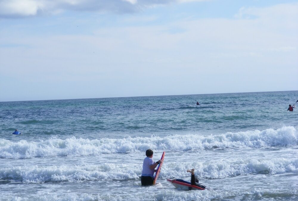
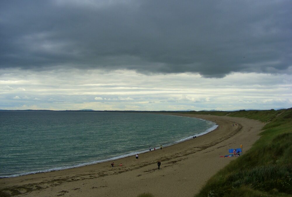
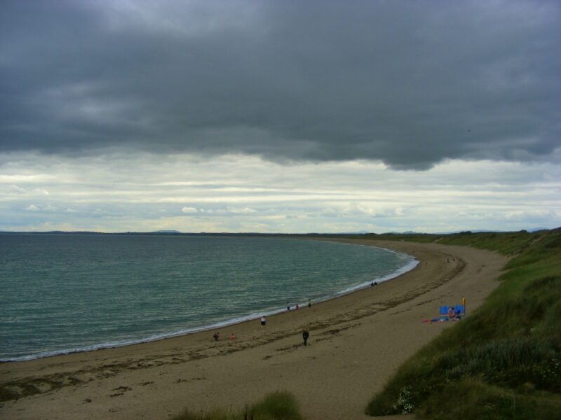
Whiting Bay is quite an open beach, the type of place surfers might go to or people who are looking for a swim in the waves. On the day we were there young and old were out among the waves with their boards.
As it can be quite windy here do bring your windbreak if you are planning to stay for a while. The beach itself is quite long so it’s good for walking as well as swimming.
There is a decent sized car park and a rough path from it to the soft sand – manageable for buggies but very difficult for wheelchairs’
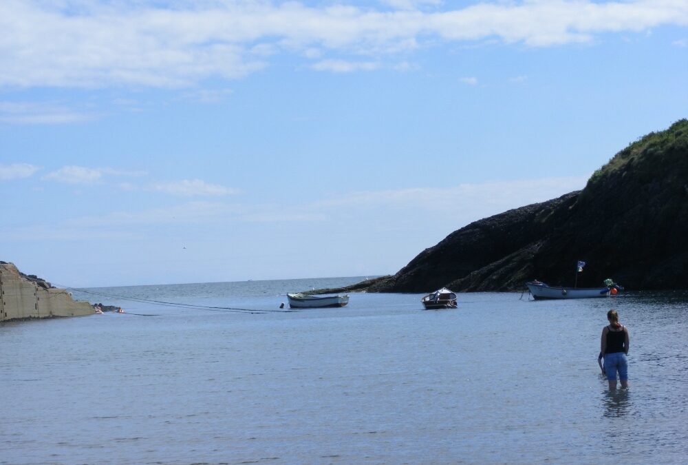
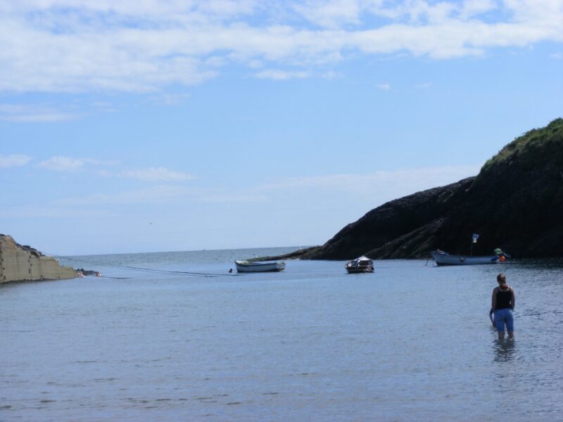
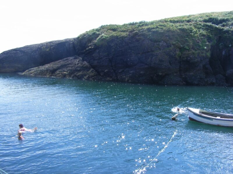
Balllymacaw is a very attractive, out of the way cove, not well signposted and not very well known. If you do find it is well worth the effort.
The cove is sheltered by small, rocky cliffs on either side. Access to the water can be from the rough slipway which leads to the small, stony beach. From here there is a gradual wade in so it’s good for children.
Alternatively, you can follow the rough path to the left of the bridge which leads you to a small pier cum landing area. The steps here bring you into clear and deep water, even when the tide is low.
The beach here is more stones than sand and when the tide is in it gets covered so don’t come here with too many buckets and spades. However, if you are looking for a quiet place for a good swim in clear water, then this is a good choice.
Directions
From Tramore take the R675 toward Waterford. Not far outside the town you take a right turn onto the R684/685 toward Dunmore East. Follow this road and watch out for a sign posted right turn for Ballymacaw . After this you are on your own as we didn’t see any more signposts and the cove itself isn’t signposted. Just ask the friendly locals
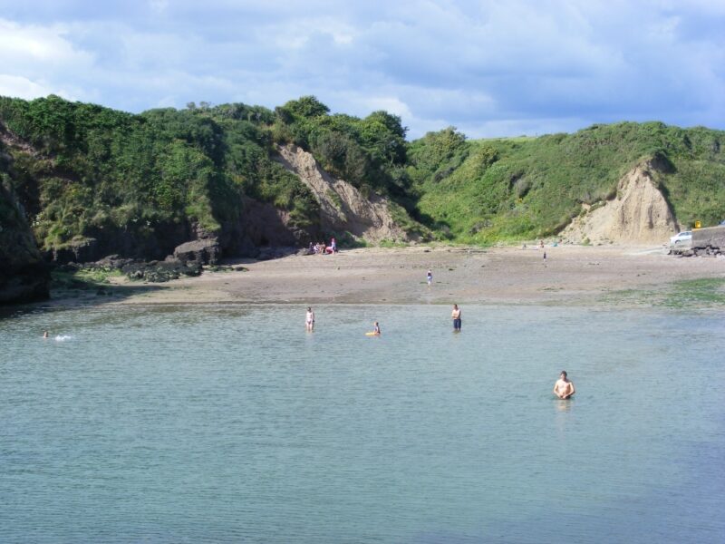
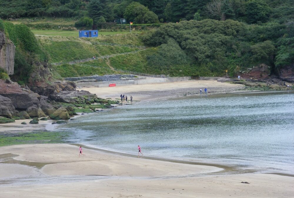
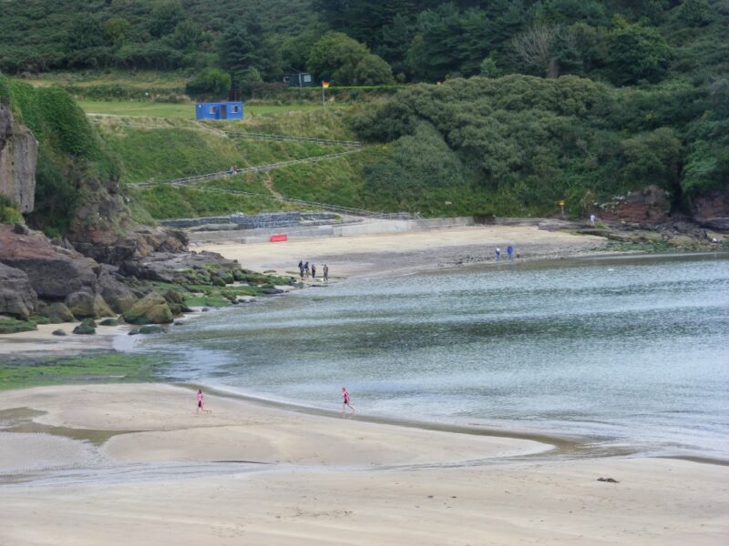
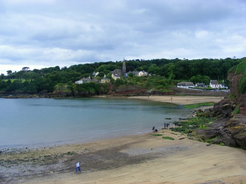
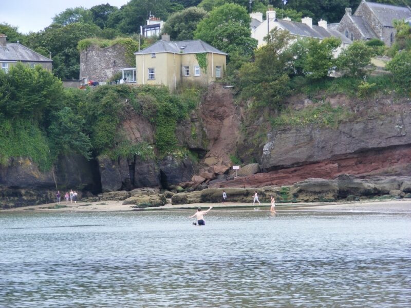
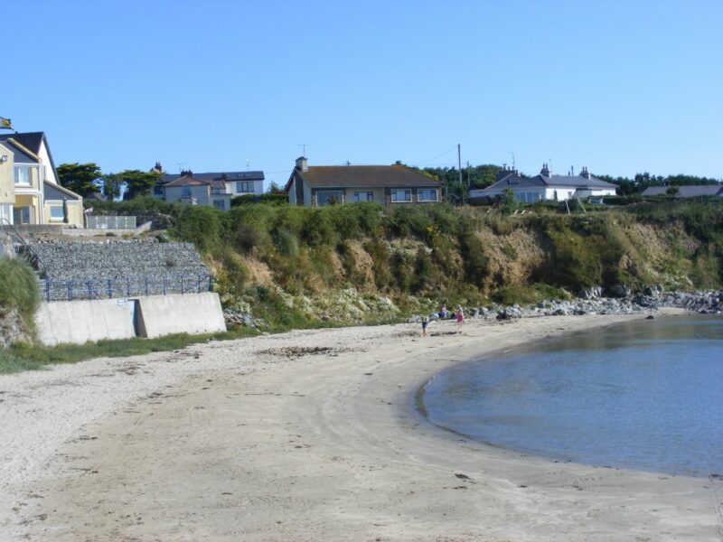
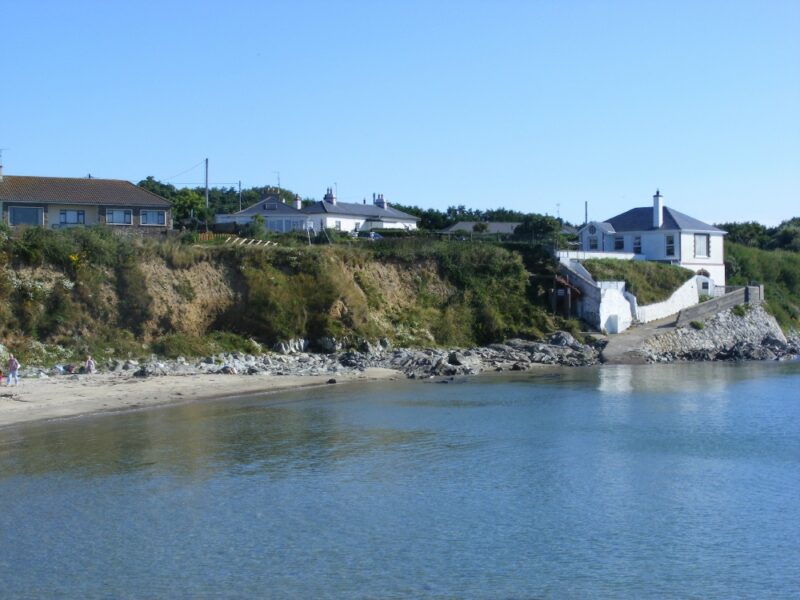
The beach at Dunmore East is small, curved and well sheltered. It is divided by rocks into two, with a smaller section to the left. From the road there is a steep slipway descent to the main section, which is certainly not for wheelchairs. The tide comes right in here so do keep an eye on the times if you are looking for a beach to play on. When the tide is low there are rock pools for children to explore.
The water here is clear and fresh and lovely to swim in. Lifeguards are on duty during the summer months.
Although it wasn’t signposted, there is a good sized car park to the left of the village (follow the signpost for the golf club) and this has a flat, zig zag pathway to the smaller section of the beach which is accessible.
Lifeguards are on duty during the summer months.Blue Flag beach
There are public toilets nearby and an added feature is the attractive bar, with outdoor seating , which overlooks the beach.
Directions
From Tramore you take the R 675 for Waterford and just outside the town you take the R684/ R685 signposted for Dunmore. Stay on this road and just before you get to Dunmore there is a left turn signposted for the beach.
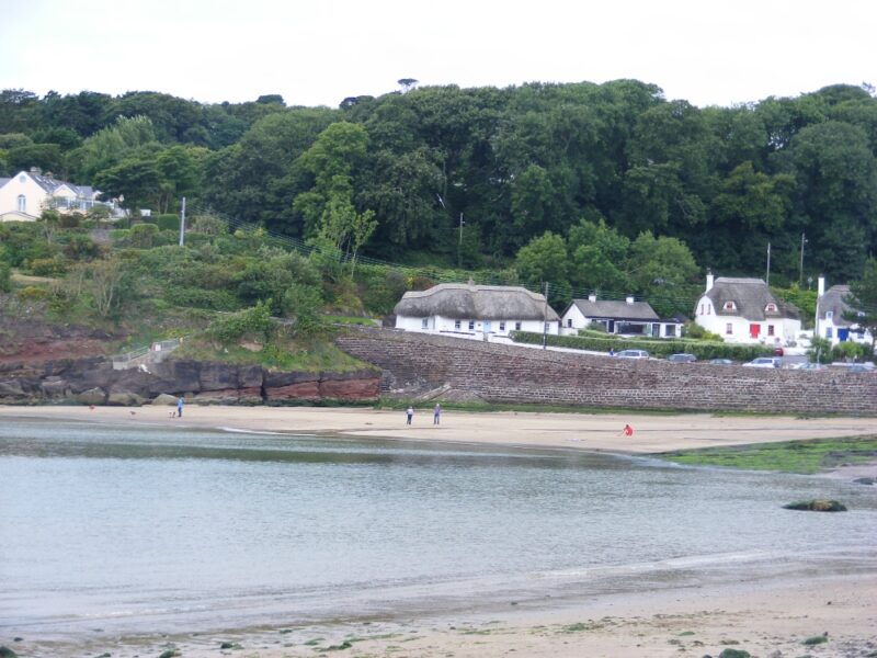
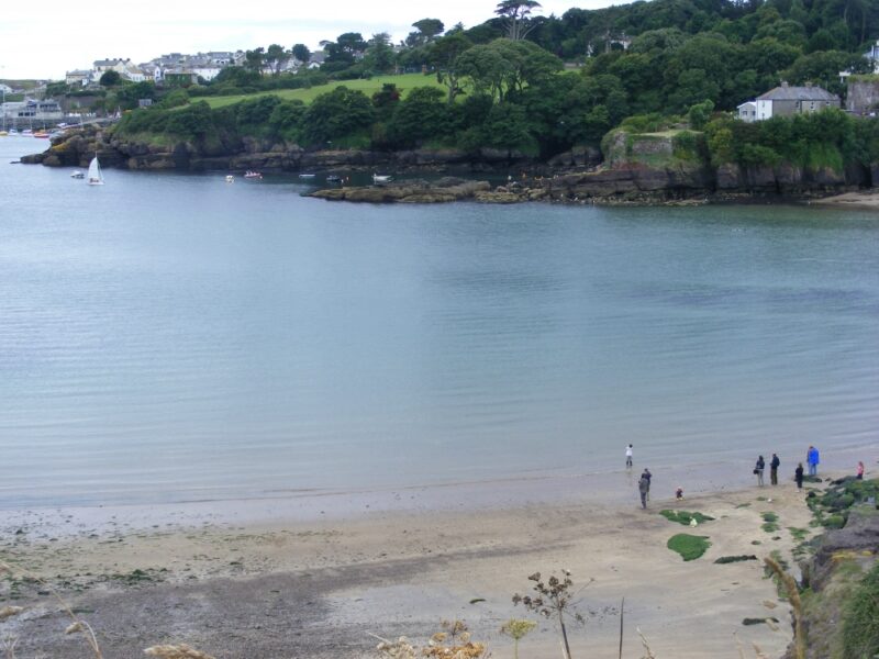
Kilmore Quay is a well-known and very attractive fishing village with a couple of very good swimming spots.
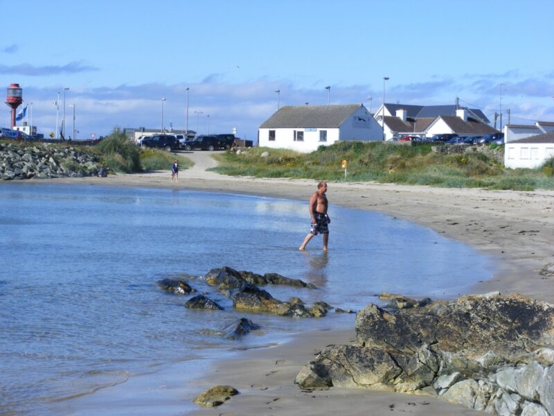
In the town itself, right beside the harbour, is a small beach with surprisingly clear water. This is a lovely place for a swim and its Blue Flag is well deserved. Apart from the lovely water, the beach is well sheltered and there are rocks at either end to rest against. The sand is soft and good for children to play on.
From the harbour, a rough path leads you the small distance to the beach and there are also a couple of seats at the entrance. Public toilets are located nearby beside the main car park. About a kilometre outside the village (turn right at the harbour), past the memorial garden, there is a long sandy beach which seems to stretch forever. Here the sea is choppier and deeper. Again, the water is fresh and lovely for swimming, but do take care as you are out of your depth quickly.
In contrast to the harbour, this beach is quite open and windy, although there are dunes behind it in which you will get some shelter.
Two lovely spots for swimming, so take your choice or, better still, try both.
From Wexford town you take the R733 in the direction of Wellington Bridge. On this road watch out for the left turn onto the R738 which will bring you to Kilmore.
Grange Strand is another of Wexford’s many fine stretches of beach, andis good both for swimming and walking. However the tide really does go way out here, so if you want a quick dip, then watch the tide times.
There are plenty of rock pools here for the kids to explore, but it does get windy so bring a windbreak if you are planning to stay for a while.
Access to the beach is via a rough track which isn’t wheelchair accessible. You will also be lifting your buggy.
There is no proper car park but there are a few places you can pull in beside the road