by Brian Kenny | Jul 7, 2011 | Cavan, Lakes
July 2011
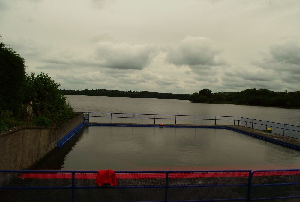
We are not quite sure of the status of this swimming pool area, located just beside Gartylough. To call it a proper swimming pool would be stretching it and there was no one there to ask when we visited. We know, however, that it is used for water safety classes.
The pool is fenced in, quite shallow and must be good for children to splash and learn. Outside the pool is the large lake itself, but we didn’t venture in on this occasion. So, more a place for children to have a swim if you are passing through, but check with Cavan County Council if it is open to the general public.
Right beside the pool is a children’s play area and toilets
View Larger Map
Directions:
From Cavan town take the R 198 toward Arvagh. As you drive through the town look right at the end of the main street for the play area and lake.
Ordnance Survey Map No: 34


by Brian Kenny | Jul 7, 2011 | Kilkenny, Rivers
Graiguenemanagh, River Barrow
July 2011
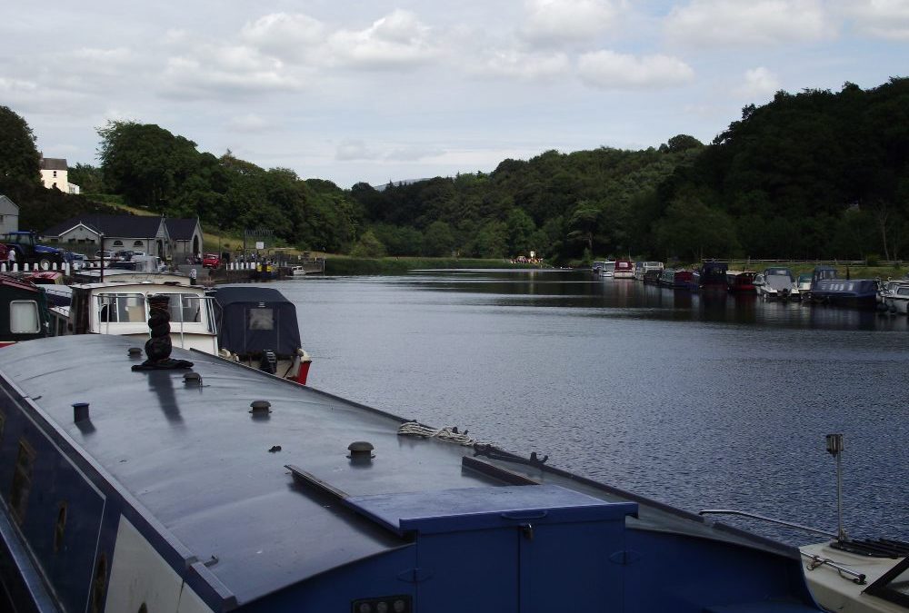
Graig, for short, is located alongside the River Barrow and is a well used boating stop. When we were there the river had plenty of boats moored with lots of people messing about in them.
There are two places to swim here, almost side by side. Unusually, the first spot has diving boards where young people can dive in and mess about. And then a bit further down the river there is a small area for swimming where lifeguards are located in the summer.
We can’t vouch for the cleanliness but the soft, river water was very refreshing when we swam there on a hot day in July.
Access seems ok for buggies, but not wheelchairs.
As well as the lifeguards there are toilets and changing rooms near to the diving boards. Credit to the local swimming club who are involved in maintaining this attractive amenity.
View Larger Map
Directions: Coming from Dublin take the M 9 for Waterford . Then take Exit 6 and get on the R705 for Bagenalstown. Stay on this road which will lead you to Graig. At the end of the town take a left turn just before you cross the river bridge and this will lead you to the diving boards.
Ordnance Survey Map No. 68


by Brian Kenny | Jul 7, 2011 | Cavan, Lakes
July 2011
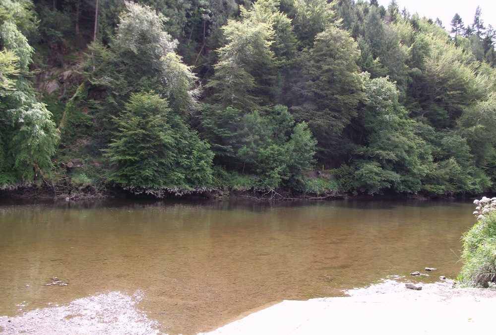
Lough Oughter is set in the very attractive surrounds of Killykeen Forest Park, a national park full of trails for walking and with plenty of water, and fish, for the fishermen.
The swimming area is a good place for a dip, with a small stretch of sand leading you into the soft lake water which is also sandy underfoot. There is quite a good depth here and as you swim out you get a panoramic view of the lake surrounded by its impressive, broadleaf forests. Don’t get carried away, though, as you are quickly out of your depth.
Be careful that you don’t swim in the other areas marked with warning signs. They are there for a reason.
Killykeen has ample parking and numerous picnic tables. There are basic toilets before you cross the footbridge to the swimming area.
View Larger Map
Ordnance Survey Map No: 34

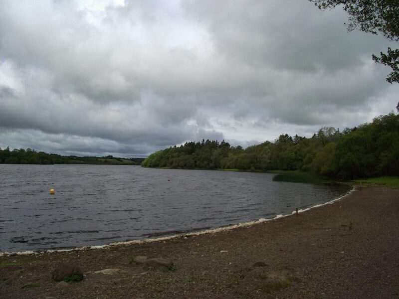
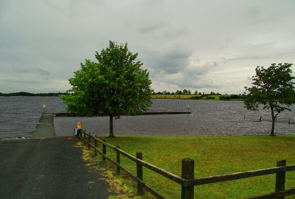
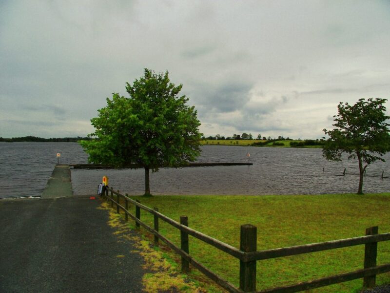
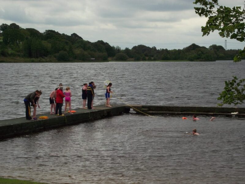
by Brian Kenny | Jul 7, 2011 | Lakes, Leitrim
July 2011
Out on its own and all the better for that. Leitrim is not renowned for swimming locations and Keeldra isn’t on the main road to anywhere, but it’s well worth the effort to find.
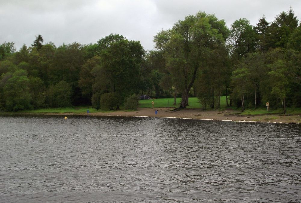
So far this is the only place we have swum in Leitrim and , hopefully, we will find more. Keeldra has a well maintained swimming area, sectioned off by a concrete walkway which creates a sheltered environment. Underfoot it is sandy and this area is not too deep. It appears to be a good place for children to swim and when we were there a water safety class was underway.
Outside this sheltered area is the lake itself but we didn’t venture that far. Keeldra is a credit to Leitrim County Council as there is a nice grassy area, picnic tables, some indoor changing areas and well kept toilets.
Directions: From the town of Mohill take the R201 for about 5 kilometres. Watch out for a right turn onto the L1566 and signposted Drumlish. After a couple of kilometres on this road you will see a left turn signposted for the lake.
View Larger Map
Ordnance Survey Maps No. 33 and 34
by Brian Kenny | Jul 7, 2011 | Kilkenny, Rivers
July 2011
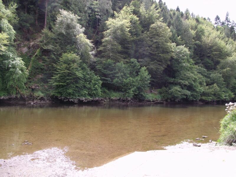
Inistioge is an attractive village on the River Nore. The swimming spot is located just outside the town. The river is tidal and when we were there it was very shallow and not attractive for swimming. We were reassured by the lifeguards that the tide comes up to a good height and you can jump in from the wall at the river’s edge.
This is a small, but attractive location. There is a car park and one picnic table.
Lifeguards are on duty during the summer.
Directions :
View Larger Map
In Inistioge take the R700 in the direction of New Ross. After you cross the bridge watch out for a sharp ( not signposted) right turn – L82831- which will bring you to the spot.
Ordnance Survey Map No. 68